
Magnitude 6.2 earthquake was registered 10 km (6 miles) ESE of Guatemala City, Guatemala on March 25, 2013 at 23:02:14 UTC. The epicenter was located 6 km (3 miles) NNW of San Jose Pinula and 7 km (4 miles) ENE of Santa Catarina Pinula, Guatemala at coordinates 14.599°N, 90.428°W. Epicenter was located at depth of 200.5 km (124.6 miles).
| Magnitude | 6.2 |
|---|---|
| Date-Time |
|
| Location | 14.599°N, 90.428°W |
| Depth | 200.5 km (124.6 miles) |
| Region | GUATEMALA |
| Distances | 6 km (3 miles) NNW of San Jose Pinula, Guatemala 7 km (4 miles) ENE of Santa Catarina Pinula, Guatemala 10 km (6 miles) ESE of Guatemala City, Guatemala 10 km (6 miles) SW of Palencia, Guatemala |
| Location Uncertainty | horizontal +/- 19.7 km (12.2 miles); depth +/- 11.4 km (7.1 miles) |
| Parameters | NST= 85, Nph= 91, Dmin=346.2 km, Rmss=1.19 sec, Gp=104°, M-type=regional moment magnitude (Mw), Version=6 |
| Source |
|
| Event ID | usb000frwy |
USGS and EMSC reported M 6.2 at depth of 200 km and local INSUVIMEH recorded M 5.8 at about the same depth. Considering the depth of epicenter, this was not dangerous earthquake. However, this is still preliminary numbers.
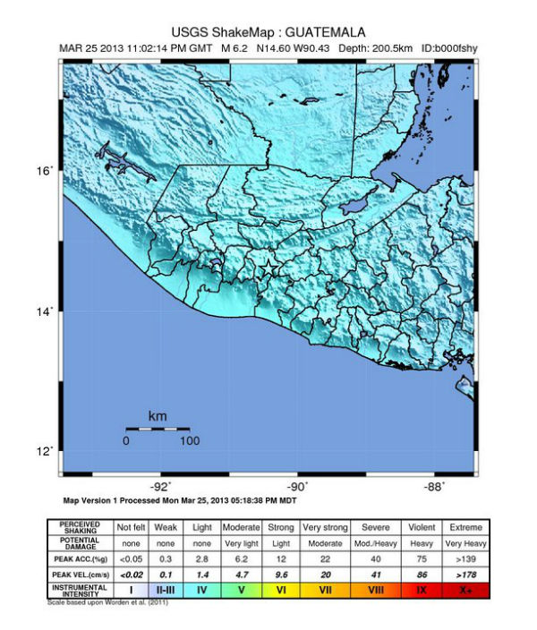
USGS Shakemap
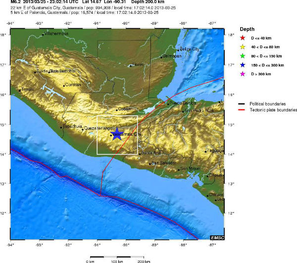
EMSC epicenter view
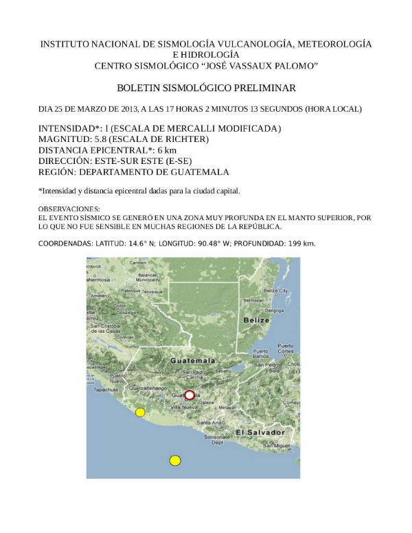
Earthquake report by INSUVIMEH
Featured image credit: EMSC/GoogleMaps
Nenhum comentário:
Postar um comentário